I wrote a previous blog post about the boom and bust of Wellington, the mining community north of Nanaimo’s original downtown which grew rapidly after Robert Dunsmuir discovered coal in the area in 1869. The exodus from Wellington was equally rapid, with a majority of the coal miners and their families moving on to the new mining towns of Extension and Ladysmith after the last Wellington Colliery mine closed in 1900. Even though the Wellington townsite essentially faded away once the mines closed, the Wellington name spread to other parts of the Nanaimo region. The mines and settlements which adopted the Wellington name were above-ground reflections of the network of coal seams that local miners followed deep below the surface.
South Wellington (#1)
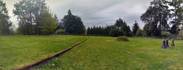
By 1877, another mining operation had started outside of Dunsmuir’s Wellington. A shaft was sunk on a nearby farm and developed into the South Wellington Colliery. An undated map titled ‘Dunsmuir’s railway and Nanaimo coalfield’ shows the original South Wellington Mine as being located between Brannen and Diver Lakes.1
This was not a Dunsmuir mine, it was owned by investor Richard D. Chandler of San Francisco, but it did tap the Wellington seam. Because it was located on the Nanaimo side of Wellington, it was indeed “south” of Wellington, but I suspect that there may have been an attempt to capitalize on Wellington coal’s growing name and reputation.
But this proved to be somewhat prophetic: by 1879, the South Wellington Colliery belonged to Dunsmuir and it became the No. 2 Mine of the Wellington workings. 1882 is the last year that South Wellington Mine is mentioned in the annual report of the minister of mines. Over time, it eventually just got wrapped up in the memory of the Wellington Mines, but for a few years at least, this first South Wellington was a distinct place.
East Wellington
The East Wellington Colliery was located on land originally owned by the Westwood family. The Westwoods had arrived in Nanaimo in 1864, and developed a 650 acre property halfway between Nanaimo and Wellington in the Mountain District. The undated railway map previously mentioned shows this mine site as being at approximately the intersection of East Wellington Road and Maxey Road. Think north of Westwood Lake, but the lake wasn’t there then, it has only existed since about 1907, when the Nanaimo Electric Light, Power and Heating Company dammed the Millstone to create it.
William Westwood died in 1872, and the coal rights for the property were eventually sold by the family to Richard D. Chandler of San Francisco, who formed the East Wellington Coal Company. Yes, that’s the same Chandler who had been the owner of the first South Wellington operations. He was a San Francisco entrepreneur, with an obvious interest in British Columbia coal mining. At first I was pretty skeptical – was it really the same investor backing the South Wellington and East Wellington Collieries, or has the story just got muddled over time? But the annual BC mining reports point to Chandler being responsible for both operations.
In the 1878 report, Chandler is not named, but the South Wellington Colliery report is signed by agent R. Wingate. In the 1879 report: “Two bores were put down by Mr. Wingate, the manager for Mr. R. Chandler, the former proprietor of the South Wellington Colliery. ” While this statement is referring to prospecting work for the East Wellington Colliery, it also makes reference to Chandler’s previous ownership of the South Wellington operation.
Robert Wingate was a successful mining engineer in the Pacific Northwest, working for Chandler at several of his coal operations. In 1879, Wingate was sent to prospect along the Carbon River, in Pierce County, Washington. Liking the potential of the site, Chandler purchased the Carbon River Coal Mining Company’s claim. A year later the company incorporated, and Wingate was named superintendent. An article about Carbonado, the coal mining town that grew up around the mine site, suggests that the reason Chandler sold off the original South Wellington Colliery was to finance these new Washington operations. The timing certainly fits. While the 1879 coal market had definitely been in a downturn, it would also make sense that Chandler was trying raise capital for investing in Carbon River.
Mining operations at the East Wellington Colliery commenced in 1882, and despite limited success, the site was continually developed in the hopes of finding good coal. A second shaft was sunk in 1887, within a kilometre of the first. In 1893, the East Wellington Mines were closed and flooded, and in 1894, in what must have felt like a repeat of the past, Chandler’s mines were taken over by Robert Dunsmuir and became part of the Wellington Colliery. Dunsmuir pumped out the mines initially, but work only recommenced for a short period following the change in ownership.
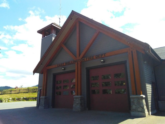 Today part of the Regional District of Nanaimo’s Area C, the land around the former colliery is now primarily residential, with a definite rural feel. Although the coal days are long over, small reminders of Vancouver Island’s mining history can still be found in the street names in the area. The local improvement district, the Mountain Fire Protection District, has also chosen to maintain the East Wellington name for its fire department and new fire hall. As a side note, it was interesting to read the City of Nanaimo’s May 2018 report about the currently undeveloped park at 2191 East Wellington Road.2 The Nanaimo Model Airs, a local model aircraft flyers club, approached the city with an appeal to create a safe flying site for model aircraft. The East Wellington Park is now being considered as a possible location for the concept. What the coal miners of days past would think about drones and remote controlled planes flying overhead, I can’t imagine!
West Wellington
A few kilometres out of Wellington and adjoining the western border of Dunsmuir’s land, another San Francisco investor, Dennis Jordan, Esq. started up a mining operation, calling it West Wellington. Although some earlier work had been done, in 1895 operations resumed, including building a tramway to Jordan’s wharf in Nanoose Bay. By 1896, the mine was owned by the West Wellington Coal Company Ltd. Getting the coal to market proved to be difficult for this company, and the operation was closed after just a few years. In 1907, the West Wellington Coal Company’s coal rights were acquired by the Gilfillan Colliery, but this also proved to be a short lived venture, closing the next year. The final attempt at this mine was in 1928, when the Little Ash Mine opened at the site. This was a small operation which closed down after just a handful of years.
North Wellington
In 1925, Island Collieries, which was owned by King & Foster Company Ltd., opened north of Wellington, with the intention of recovering pillars from the original Wellington Mines. This was a small operation, employing just 10 men. Henry Shepherd was the superintendent, resulting in many remembering this operation as Shepherd’s Mine. By 1927, the mine was owned by Canadian Collieries (Dunsmuir) Ltd., which was what Dunsmuir & Sons was renamed after it was sold by family in 1911. The site was renamed Wellington Extension No. 9. Like many small operations of the time, the No. 9 closed periodically due to downturns in the coal market, and did not work again after 1932.
South Wellington (#2)
As part of the exchange for agreeing to build the E&N Railway, Dunsmuir’s newly formed Esquimalt & Nanaimo Railway Company received a huge land grant, amounting to approximately 20% of Vancouver Island. This included the mineral rights for nearly 800,000 hectares. Not long after this deal went through, Dunsmuir began to explore coal prospects up and down the Island in the railway belt. In 1884, the Alexandra Colliery3 was opened in the Cranberry District, just south of the Vancouver Coal Mining and Land Company’s Southfield Mine. The mineral rights for the area had previously been owned by early settler and local land owner James Beck, but no substantial mining was done until after Dunsmuir acquired the rights.
The mine didn’t turn out to be as successful as hoped. It ran for just a few years before it was closed down for a decade. But by 1895, work had resumed again at the site, and as was typical of coal mines at the time, a small settlement grew up nearby. The townsite shared the mine’s name and was called Alexandra, a tribute to the Princess of Wales, Alexandra. But in 1899, when the community made an application to the post office, it was pointed out that a very similar name had already been in use for some time in the province.4
The now unused South Wellington name was repurposed for this new Dunsmuir mining community. A likely reason for this was to keep the mine and its coal associated with the Wellington reputation that had already been developed. In reality, this was somewhat of a misdirection, as the mines in South Wellington accessed the Douglas coal seam rather than the Wellington.
On August 1, 1899, the post office opened and the name South Wellington officially moved even further south. Locals describe the boundaries as: “an area bordered on the east and south by the Nanaimo River, [with Cedar on the river’s east bank and Cassidy on the south bank], to the north by what are now Nanaimo city lands [approximately the Duke Point Highway], and to the west by a large forested area and a ridge which separates it from Extension and Cinnabar.”5 This is the South Wellington I know and love, and if you ever hear anyone talk about South Wellington today, this is almost certainly the one they are referring to.
Today South Wellington isn’t as densely populated as it would have been at the time of active mining. Instead of people living clustered around the mine sites, homes are now spread throughout the rural area. Minto Avenue is no longer a main drag with stores and boarding houses, but a quiet residential street.
From 1869, when Dunsmuir made his first discovery at Wellington, to 1951, when the No. 10 Mine in South Wellington closed, coal was king in the Nanaimo region. If underground seams proved profitable, the townsites flourished and grew; but when the coal played out, the towns faded away. The Wellington townsite itself was practically deserted after just a short period, but its influential name spread north, south, east, and west throughout the Nanaimo region, leaving behind clues about coal mining’s impact on Vancouver Island.
Notes
1. Viola Johnson-Cull, Chronicle of Ladysmith and District (Ladysmith: Ladysmith New Horizons Historical Society, 1980), 356.
2. Kirsty MacDonald, City of Nanaimo, Staff Report for Decision: Pilot Park Site for Nanaimo Model Airs Radio Control Flying Club, 2018, File No. A2-4-1/D1-4-37, Nanaimo, B.C. https://www.nanaimo.ca/docs/default-document-library/eastwellingtondrive.pdf (accessed July 25, 2018).
3. The mine is remembered as the Alexander, the Alexandria, and the Alexandra. Even the Minister of Mines annual reports aren’t consistent from year to year.
4. Fort Alexandria was opened north of Williams Lake on the Fraser River in 1821, the last fort to be established by the North West Company before it merged later that year with the Hudson’s Bay Company. Alexandria was named after Sir Alexander Mackenzie in recognition of him being the first European visitor to the area in 1793. G.P.V. Akrigg and Helen B. Akrigg, 1001 British Columbia Place Names. (Vancouver: Discovery Press, 1973), 15.
5. South Wellington Historical Committee, South Wellington: Stories from the Past 1880s-1950s. (Victoria: First Choice Books, 2010), 1.